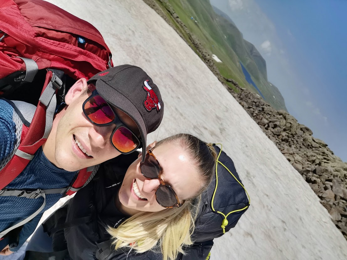
Armenia: 3-day hike to Azhdahak Mountain
After falling in love with the Georgian mountains, Armenia got on top of our bucket list. We spent a couple of days working from Yerevan (which didn’t impress us except for its great food) and then went for a 3-day hike to Ghegam mountains. What we experienced there totally overcame our expectations.
We decided to go to the Ghegam mountains since it’s just a 1-hour drive from Yerevan but not as crowded as more popular locations such as Tatev or others. We’ve planned the hike for 3 days with what was supposed to be 12-15 km per day (spoiler alert: that plan didn’t work out).
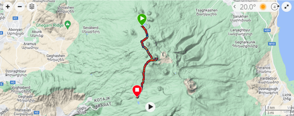
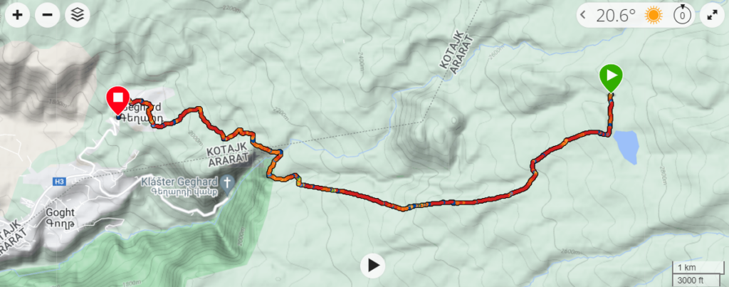
- Day 1: Sevaberd – Akna Lake: 11.89km, 7 hrs 23 min, up 1,153m, down 198m
- Day 2: Akna Lake – Azhdahak Mountain – Vishapilich Lake: 21.47 km, 9 hrs 50 min, up 799m, down 1,079m
- Day 3: Vishapilich Lake – Geghard: 14.1 km, 5hrs, up 99m, down 895m
Tip: Since we were working from Yerevan before the hike, we had our laptops with us. And you don’t want to carry laptops in your back pack while hiking. We used the luggage storage at Yerevan airport and left a bag with laptops and others stuff we didn’t need there. It costs 3,000 Drams per day.
Day 1: Sevaberd – Akna Lake

We took a cab (using GG app) from Yerevan to Sevaberd. You can probably get there also by mashrutkas but we didn’t want to waste time with that. The taxi from the airport to Sevaberd was 8,000 Drams and it took about an hour to get there. Sevaberd is a small village at the end of the world, we didn’t notice any shops there so if you need to buy food or water, do that beforehand.
We started from the North-East end of Sevaberd village where you can basically walk to the mountains. Don’t expect any official gate or trail marks, just walk in and let yourself immerse in the mountains. 😉
Don’t let the tracks that lead from the road to confuse you (they did confuse us). You want to head straight to the East towards the mountain ridge, while the tracks might lead you South-East. We were lucky to meet a local Yezidi shepherd who told us (“rukami” as there was no other common language between us ☺) to head back North-East.
We not only took a bit longer path but it was also more complicated since it lead over several rocky boulders. We could have saved some time by going through the valley and passing the Yezidis tents there, but this way was definitely more rewarding. You’ll get snow, big rocks, lakes, beautiful views, and 100s of different flowers on the go.


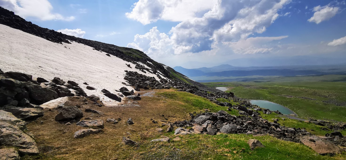

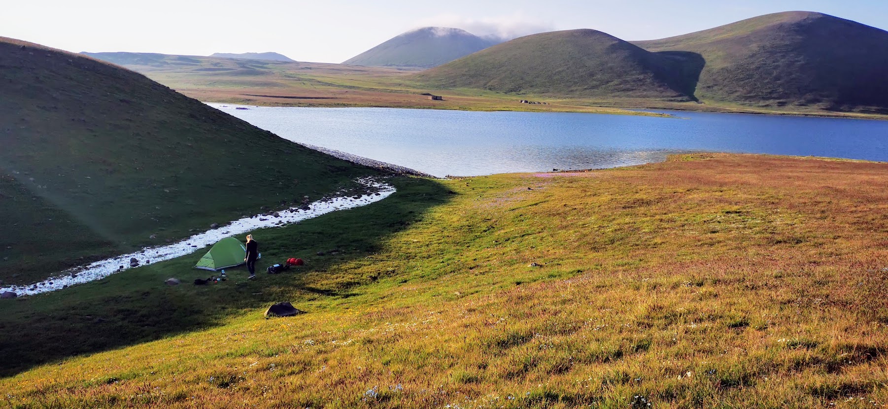
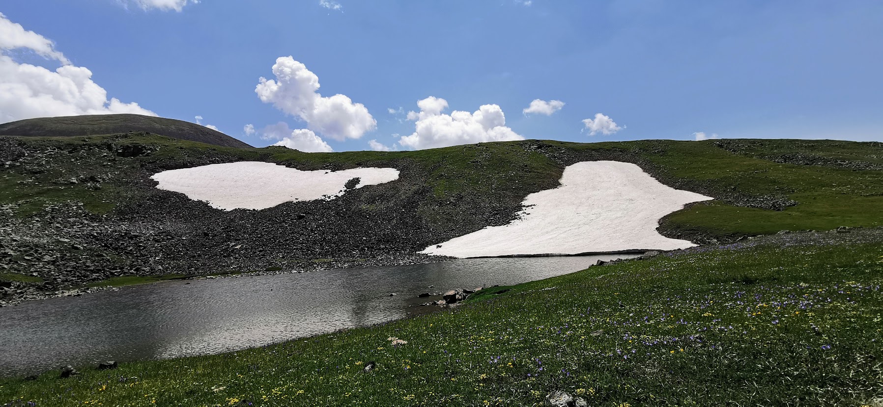
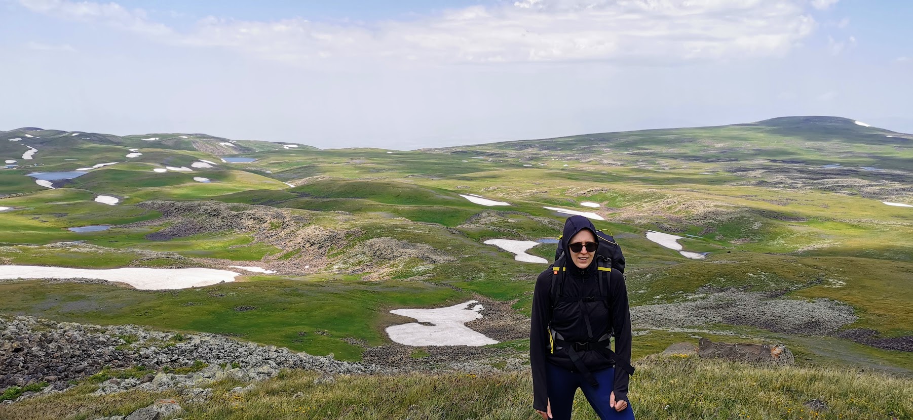
After about 7 hours we hiked the last hill and finally saw what we were looking for: Akna Lake. It’s a large lake hidden between 3 mountains and to see it for the first time made us so happy! There was already one group setting up their camp and also one Yezidi camp on the North side of the lake so we decided to set up ours in a small valley right next to the stream inflowing to the lake. We couldn’t wish for a better place since we were just next to the water source and protected from the wind by the little hills on both sides.

Day 2: Akna Lake – Azhdahak Mountain – Vishapilich Lake
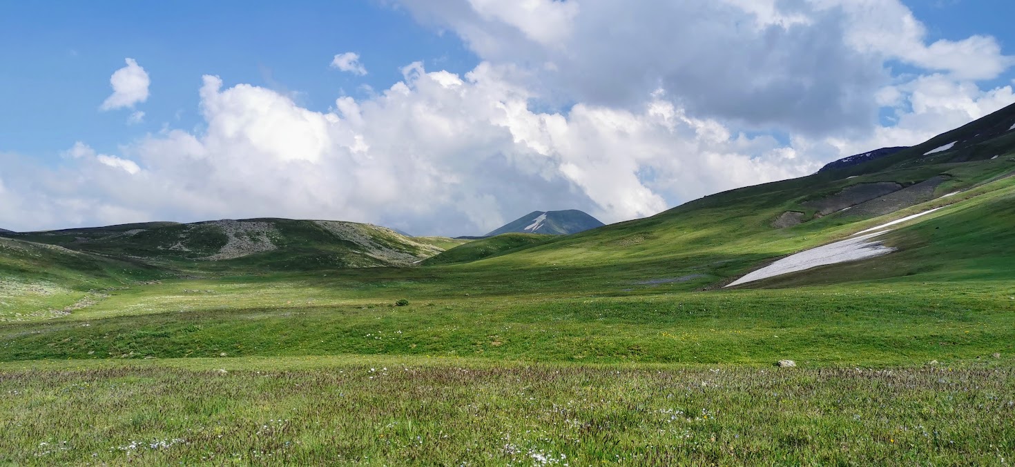
If you think we got lost the first day, trust me it was nothing compared to day 2. But what others call “got lost”, we call “explore more exciting ways to get there”. The plan seemed simple: from Akna lake, walk toward Azhdahak mountain – which you can see from the lake and is the highest mountain here so you can’t lose it, can you? – and then continue to Vishapilich lake or camp somewhere earlier.

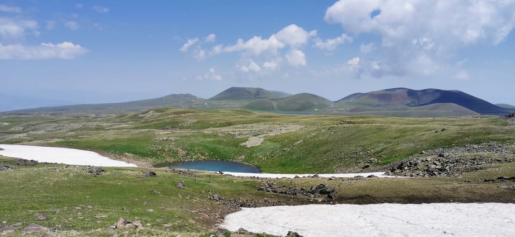
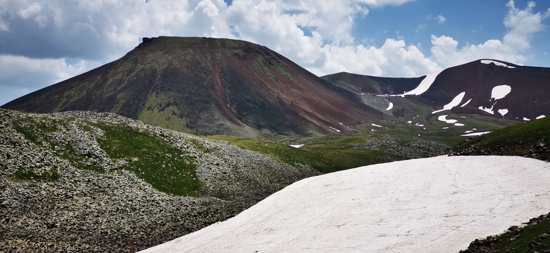
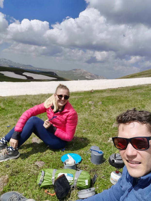
The only thing that went wrong was that we decided to go around Aghusar mountain from the West-side rather than from the East where is supposed to be a way easier way to Azhdahak mountain. It took us good 4 hours to reach there which is almost double compared to the East way and through harder terrain but look at the views! At this moment we still believed it was worth it! By the way, water streams are super frequent all the way here so you don’t have to worry about carrying too much water from Akna lake.
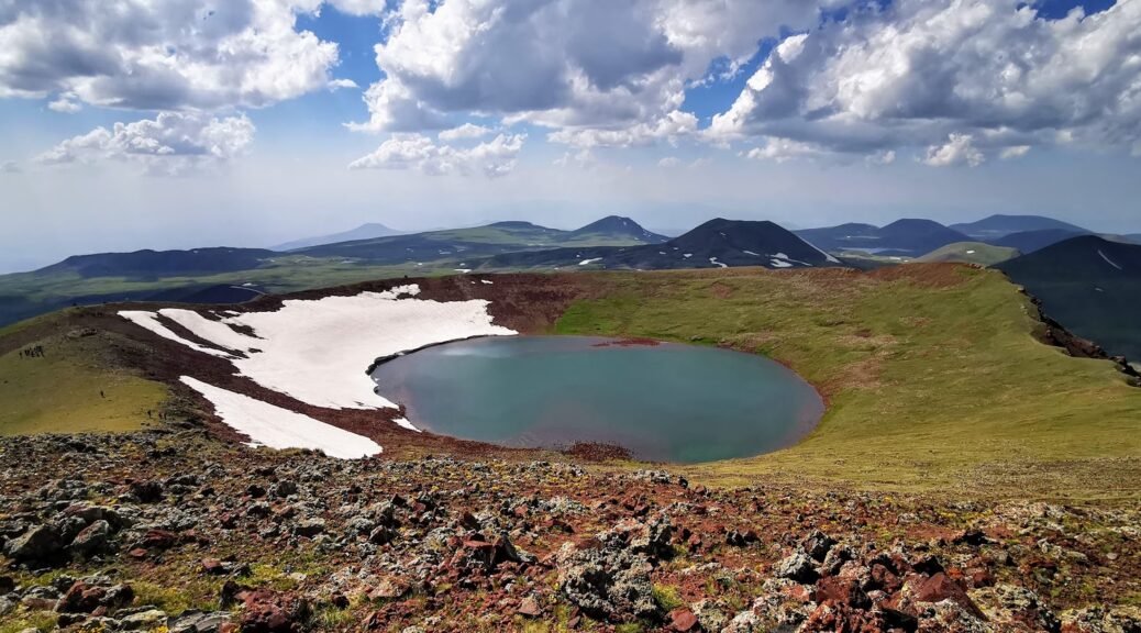
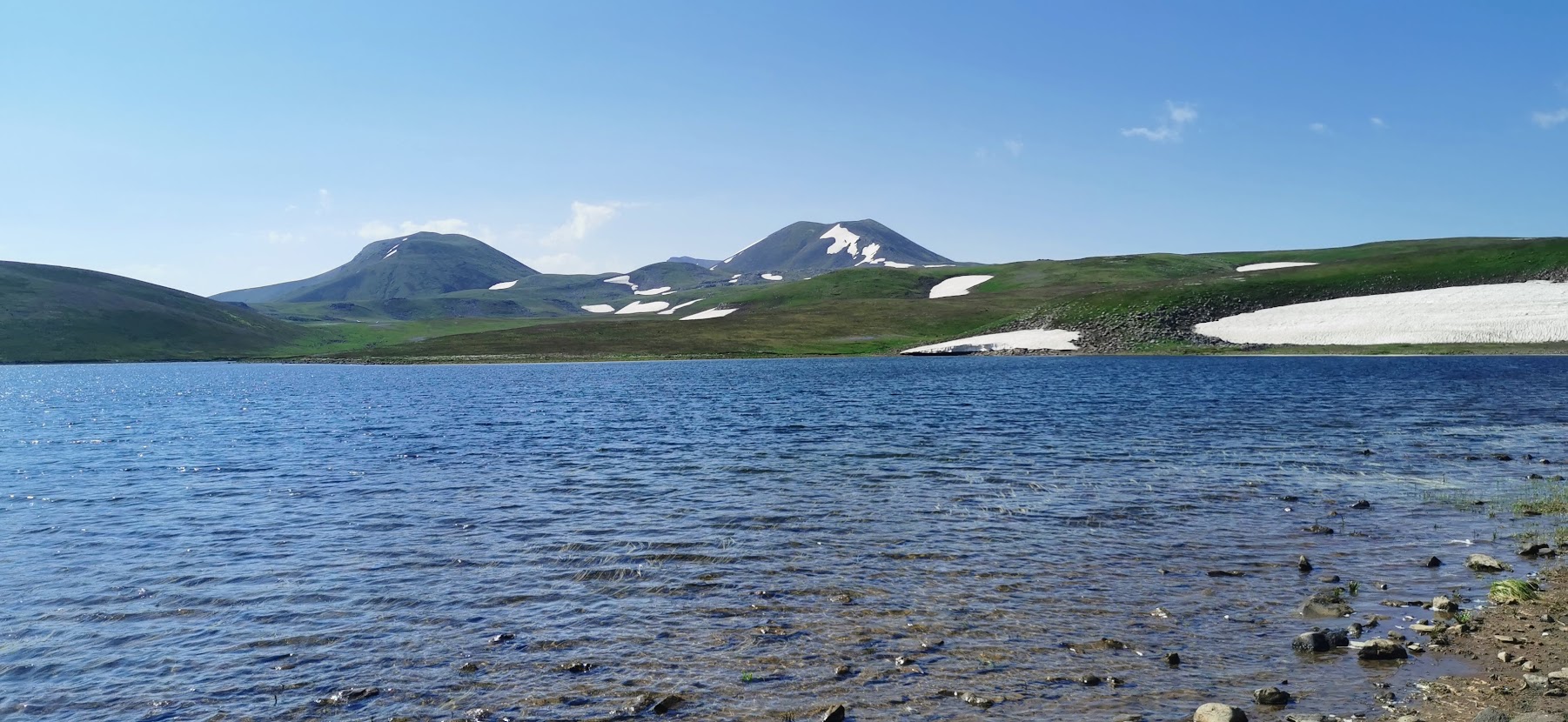
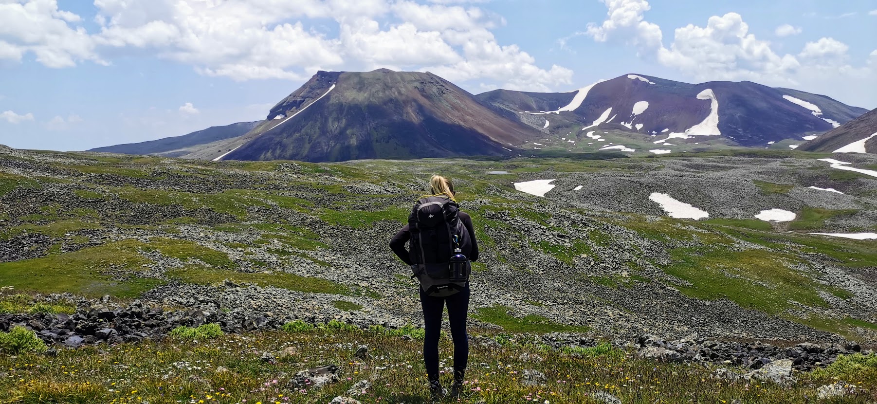
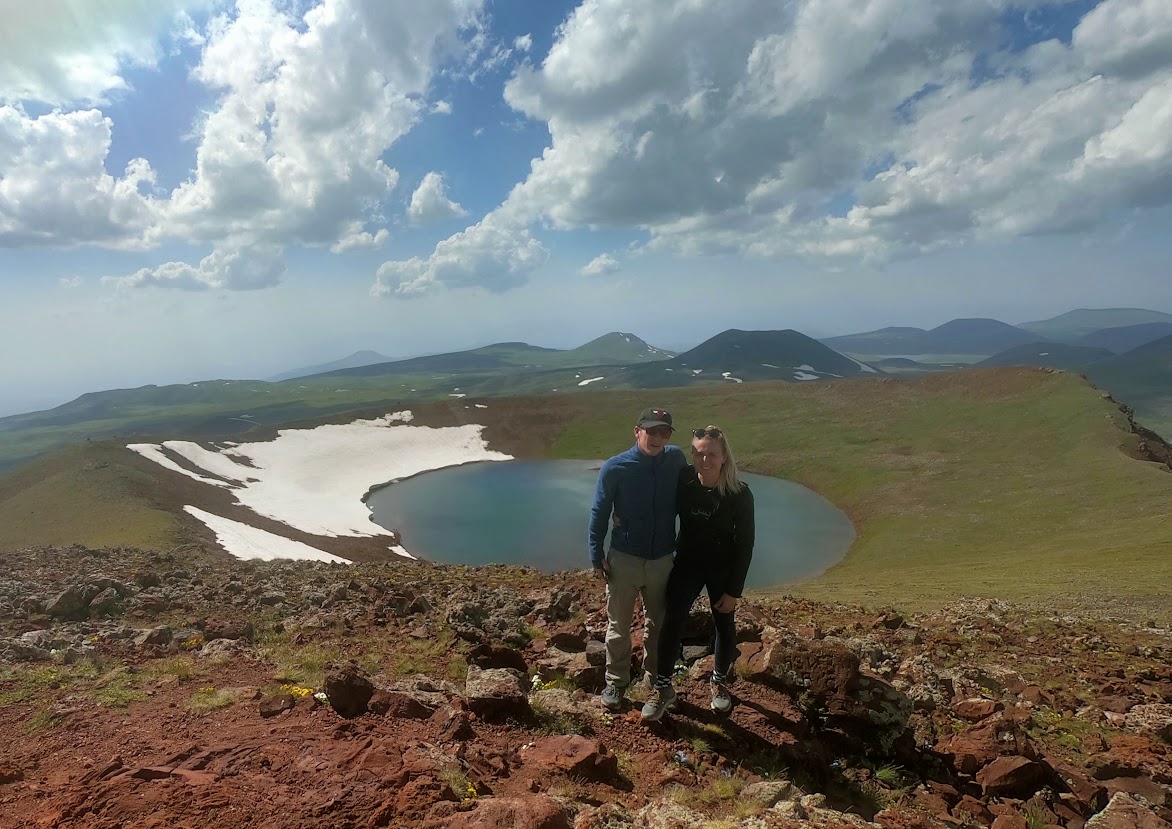
There are supposed to be two ways leading up the Azhdahak, we took the south one which is easily seen from the foothill. The whole way up is an easy-to-follow path but with a serious incline. You start at around 3,000 meters above the sea and the mountain top is at 3,556. We had a lunch break mid-way up when we met another freshwater stream. All the hustle becomes totally worth it once you get yourself to the top and see the lake in the mountain crater. This is something we’ve never seen before and it was one of the best views EVER! You can walk around the whole mountain to see all the sides. You can even see the shore of Lake Sevan which is on the border with Azerbaidzan.

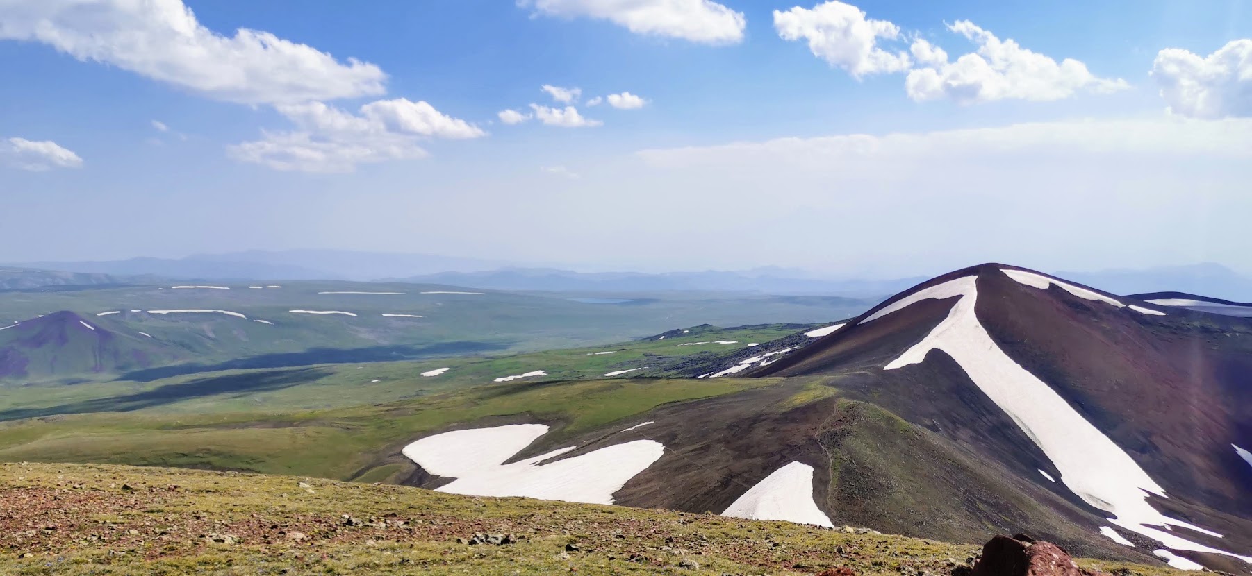
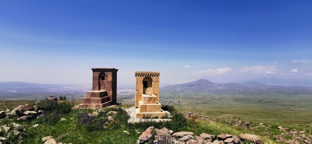
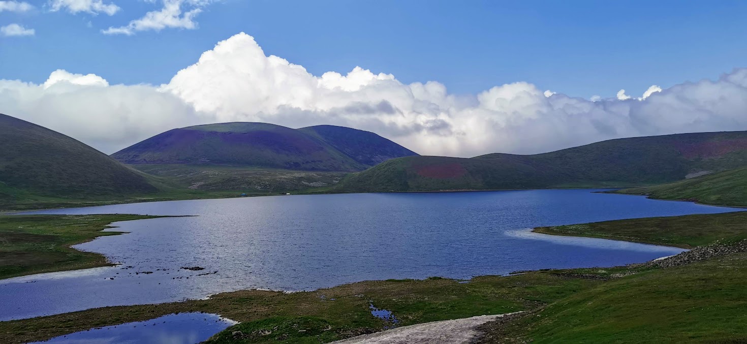
From the volcano, we headed around the nearby mountain in the South direction to reach Vishapilich Lake before sunset. Again, we’ve met several water streams on the way so we were quite confident we can camp anywhere on the way should the plan not work. After the last break which was way after 5 PM but still good 4-5 km from the lake, Anna kicked in turbo pace for us to make it. Ironically, this last part was the only one during the whole day we didn’t meet any fresh water and had to keep walking. Luckily on the way, we saw a few stones with petroglyphs which are scattered around this area.
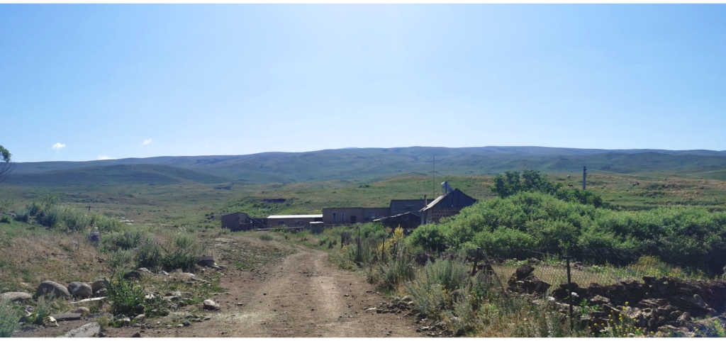
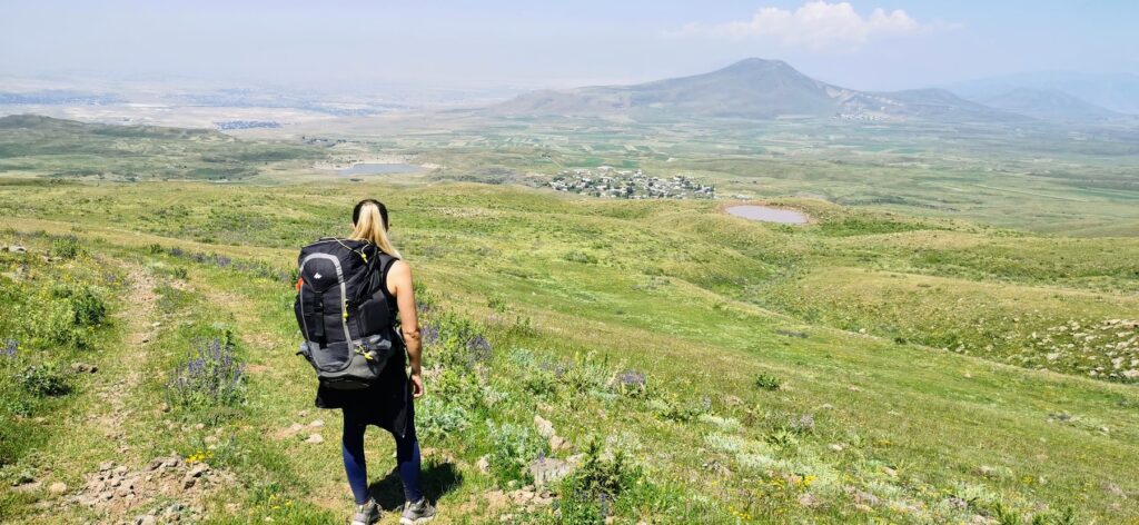
You can see the lake the whole time and it still appears so far! Around 3 km from the lake, you will meet Yezidi’s villages and start noticing the first civilization as they’re building waterpipes taking the water from the lake to the villages. That gave us no other option than keep walking. Just a couple of hundred meters we were walking around that water pipe and heard a stream of water. We followed it and found a great hidden spot near the stream and we knew nothing will make us continue after those 21 km. The spot was in between a triangle of villages and given there were mountain dogs (of a bear size) in all of them, it wasn’t the calmest evening but our legs were done with walking for the day.
Day 3: Vishapilich Lake – Geghard
Waking up with the first shepherds taking their sheep out, we headed towards the lake which was just 10 minutes away. That’s where we also saw two famous dragon stones and headed towards Geghard village. Our legs were dead after the previous day so we were happy it was an easy dust road heading down. We’d even meet a couple of cars which felt super unusual.
It was still 14 kilometers walk but felt really easy and enjoyable with a view of Mount Ararat peaking its head above the clouds. Around 45 minutes from Geghard we make the last lunch break and headed to the village. We tried to search for a mashrutka there but locals told us we’ll need to get to a bigger village for that. We decided to give a try to GG App again and totally unexpectedly a guy from a nearby village confirmed the ride and took us back to Yerevan for a friendly 5,000 AMD.
The whole hike was unbelievable. The mountains there are beautiful, it feels like there is never-ending nature around you and you can just walk wherever you walk. The views of the snowy islands and little lakes were just unforgettable. That’s why – despite walking many extra kilometers – we came back home in total awe of Armenian mountains and are sure we’ll be back soon.
I love the airport buzz, planes and most of all – the feeling when you discover or experience something new. Together with Anna, we launched our gift voucher platform Ithara.ae. Photos are usually taken with Canon EOS 4000D, my Huawei Honor phone and DJI Mavic Pro.